CP180I
Standard Horizon CP180I 5in GPS Chart Plotter (Internal GPS Antenna)
The CP180i (with internal GPS antenna) are precision-crafted GPS Chart Plotters with high-performance receiver for the Global Positioning System (WAAS GPS) constellation of satellites, providing precise location data with a host of navigation features. Ideal for nautical use and sealed against water ingress.
The GPS Chart Plotter is housed in a rugged, impact-resistant case with outstanding ergonomic design, for effortless operation.
Features:
- Direct sunlight viewable color LCD display
- Capable of using the Optional FF520 50/200kHz BLACK BOX FISH FINDER
- C-MAP NT+/MAX cartography compatible
- Improved Worldwide background showing detail up to 2.0 NM
- GPS WAAS Smart Antenna
- CP180i: 600 Waypoints (Marks) / 20 Routes storage
- User selectable data fields
- AIS Support with 3rd Party AIS Engine.
- NMEA Data pages for CP180/CP180i: 3 NMEA Outputs and 2 Inputs
- 3 year limited warranty, lifetime flat rate
| Power Consumption |
460mA Max @ 12VDC |
| Power Supply |
10 -35 VDC |
| Display |
TFT Colour LCD ( Active Area 5in) Sunlight viewable Technology
|
| Display Resolution |
320 x 420 pixels |
| Cartography |
C-MAP NT+, C-MAP MAX |
| Operating Temperature |
-18°C ~ +55°C |
| Storage Temperature |
-20°C ~ + 77°C |
| Water Resistance |
Splashproof |
| Memory |
Internal non Volatile storage for user data backup |
| Keyboard |
Silicon rubbe, backlight |
| Dimensions |
181 (W) x 111 (H) x 44 (D) mm |
| User Points |
Marks/Waypoints 600 |
| Routes |
20 ( Max 30 waypoints per route |
| Trackpoints |
3000 ( recordable in 5 Tracks) |
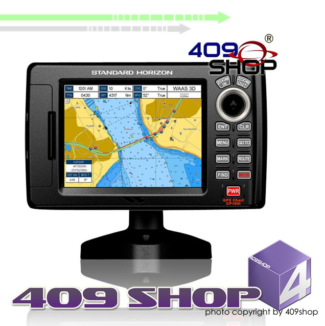
Photo will have chromatic aberration compared with the product
|
|
|
- 1 x External bracket (includes the knob)
- 1 x Dust cover
- 1 x Power data cable
- 1 x Manual
- 1 x Quick Reference Guide
PY | | | | | | | | | | | |
|